

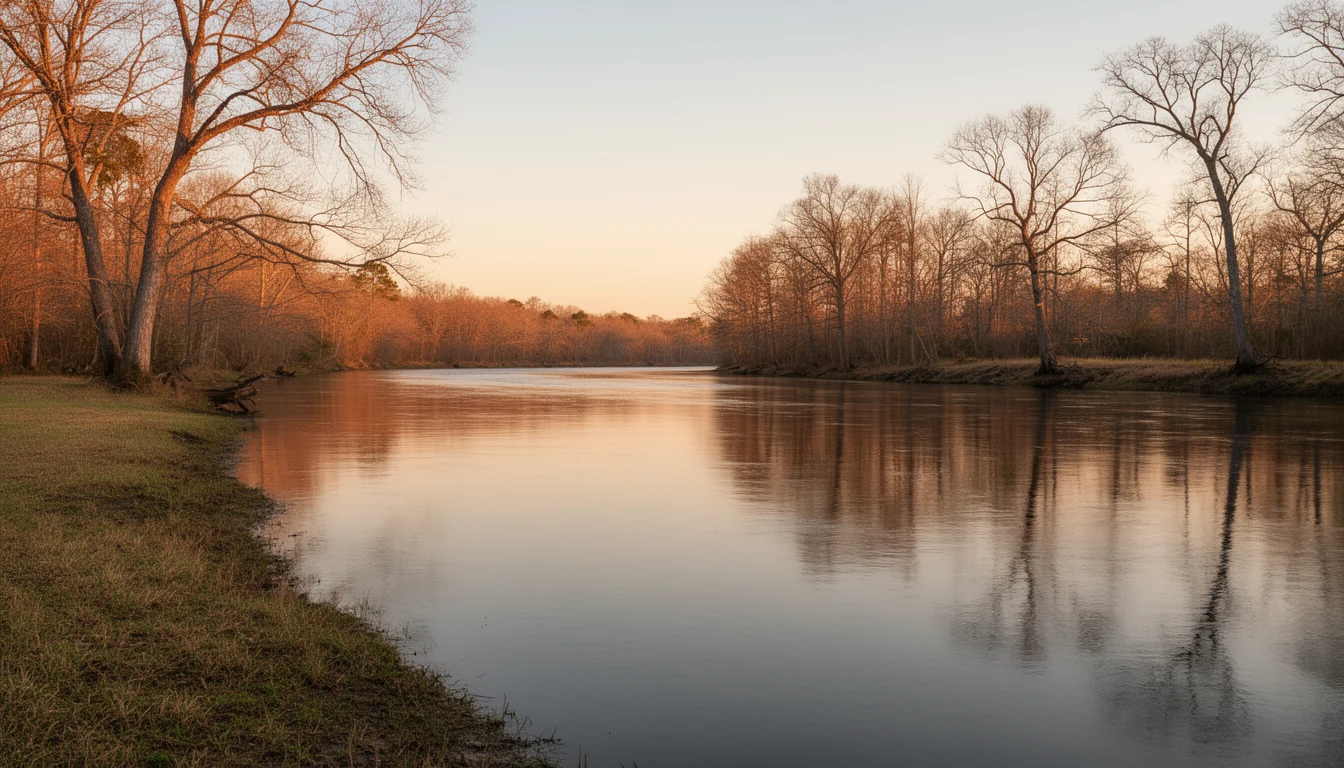
Hertford County sits in North Carolina's northeastern corner, bounded on its eastern edge by the Chowan River and cut through by the Meherrin and the Wiccacon. Long before there was a county, or an English name for any of it, this was a place organized around those same rivers — a fact that has never really stopped being true.
Pre-1650s Chowanoke Country
Before Hertford County existed, this was Chowanoke country. The Chowanoke were an Algonquian-speaking people living along both banks of the Chowan River, with tribal lands reaching across much of what are now Gates, Hertford, Bertie, and Chowan counties1. When Ralph Lane led an expedition inland from the Roanoke colony in 1585–86, he described a substantial nation of many villages, with its principal town — also called Chowanoke — located near present-day Harrellsville, in what is today the southeastern corner of this county2. Lane put the town's fighting strength at 700 to 800 warriors, implying a total population in the low thousands — a scale of settlement most visitors to rural Hertford County today would not guess had ever existed here. Archaeological work at the town site in the 1980s confirmed Lane's account of its location and found evidence of occupation stretching back roughly a thousand years before European contact.
What came after is a familiar and hard story. Epidemic disease — a 1696 smallpox outbreak chief among it — combined with the Chowanoc War of 1675–77 and the Tuscarora War of 1711–13 to devastate the population across the following century. By 1701 the Chowanoke had contracted to a single village on Bennetts Creek; in 1733 the survivors formally merged into the Tuscarora Nation, and by 1820 the Chowanoke were recorded as extinct as an independent people3. The county that eventually formed here inherited land the Chowanoke had occupied for a millennium, under a name — Hertford — that has nothing to do with them.
1691–1729 The Meherrin Arrive
The Meherrin — an Iroquoian-speaking people who call themselves Kauwets'a:ka, "People of the Water" — trace their own migration back roughly a thousand years, from the Mississippi River valley down the Kanawha, eventually settling in southern Virginia along the river that still carries their name. They moved into present-day North Carolina around 1691, and Virginia had already assigned them a reservation called Maharineck in 1705, before that colonial border fully separated their people from their land. By 1729 the Meherrin had become tributaries of the Province of North Carolina4, and a reservation was established between the Meherrin and Chowan rivers, in what is now Hertford County.
Their descendants never left — one of the oldest continuous threads in the county's story.
Unlike the Chowanoke, the Meherrin's presence here did not end. A modern tribal government was organized in 1975, and in 1986 the Meherrin Indian Nation became the sixth tribe recognized by the State of North Carolina. Today it is headquartered between Ahoskie and Murfreesboro, holds an annual powwow on tribal grounds the first week of October, and remains one of the oldest continuous threads in the county's story — not a historical footnote, but a governed nation still headquartered on ground its ancestors settled three centuries ago.
1759–1766 Hertford County & Winton Founded
Hertford County was formed in 1759 out of pieces of Bertie, Chowan, and Northampton counties, part of the same wave of colonial subdivision that was carving smaller, more governable counties out of North Carolina's original Albemarle-region territory. It took its name from Francis Seymour Conway, Earl — and later Marquess — of Hertford, an English nobleman who almost certainly never set foot here; naming a new colonial county for a distant peer was routine practice in the era, a flattery gesture rather than a personal connection1.
The county seat grew up on a bluff above the Chowan River, at a crossing first known as Cotton's Ferry. The General Assembly incorporated the town there in 1766 as Wynntown, and it became Winton not long after — the name it has carried ever since, and one of the smallest county seats in North Carolina to this day. That same bluff geography — high, defensible ground directly on a navigable river — is what made Winton useful as a river crossing and county seat in 1766. Ninety-six years later, it is exactly what made the town a Union gunboat target.
1862 The Burning of Winton
Hertford County holds a hard distinction in Civil War history. On February 19, 1862, a Union flotilla of gunboats — the lead vessel was the USS Delaware — steamed up the Chowan River toward Winton, intending to destroy railroad bridges upstream. Confederate troops fired on the vessels from the bluff; the volleys did little real damage, but they enraged the Union command5. The fleet anchored downriver overnight, and Federal officers decided the town itself, not just the bridges, should be destroyed.
On February 20, 1862, Union forces returned to a town that had been almost entirely abandoned. They looted and then burned it — the courthouse, military stores, and the great majority of the roughly 300 inhabitants' homes and businesses. Only a handful of buildings, including the Methodist church, were left standing. Winton was the first North Carolina town burned by Union troops during the war, and the only one burned essentially in its entirety6. Historians researching the campaign have identified it as an early instance of one of the first amphibious operations in American military history, and as a real precedent for the "total war" tactics later associated with Sherman's later marches — not a footnote to that history, but an early chapter of it.
1787–1971 Murfreesboro & the River Trade
While Winton governed the county, Murfreesboro — on the Meherrin, named for the Murfree family among its early landowners — became its commercial and cultural center. Steamboats and freight boats worked the river, connecting Murfreesboro's landing to markets downriver, and the wealth that trade generated survives today as a real, walkable historic district: nine contributing buildings across roughly 100 acres, added to the National Register of Historic Places on August 26, 19717. The earliest of them, the William Rea Store, dates to around 1790 and was itself separately listed on the National Register the year before the district was. The Wheeler House (c. 1800) was the birthplace of John H. Wheeler and later home to Congressman Jesse Johnson Yeates; Melrose (c. 1810) housed Congressman William H. Murfree; and the Walter Reed House (c. 1845) was the childhood home of the Army physician whose yellow fever research made him internationally famous.
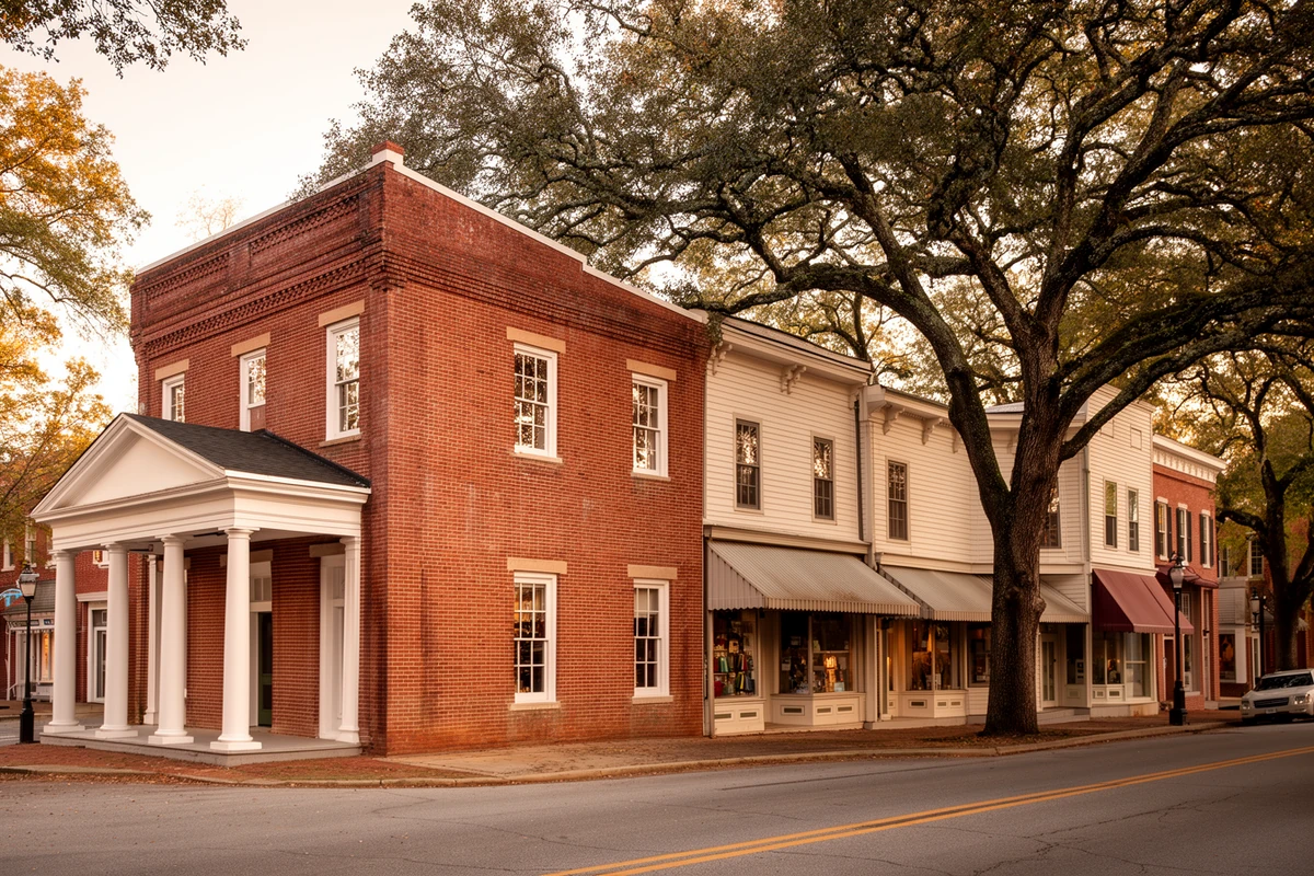
The wealth that river trade generated survives today as a real, walkable historic district — not a museum piece, but a stock of early-1800s houses you won't find in counties that grew later.
Murfreesboro is also, and has been since before the Civil War, a college town. See the next section for how that shaped the county's other river town, Winton, in a very different way.
1885–1893 Ahoskie: "The Only One"
Ahoskie has no river-trade origin story at all — it's a railroad town, and a comparatively young one. It began in 1885 as a siding for log trains hauling timber out of the Bertie and Hertford county forests to a sawmill downline, growing up around the loading station and commissaries that supplied the logging crews. A post office followed in 1889, the first passenger train ran through on the newly opened Norfolk and Carolina line in 1890, and the town was formally incorporated on January 24, 1893, by which point it already had several stores, a sawmill and gin, a one-room school, and a Baptist church8. The town's own name comes from "Ahotsky," a word associated with the Wyanoke people who were in the area at the start of European settlement.
Ahoskie grew fast for a rural North Carolina town — from 302 residents in 1900 to 1,429 by 1920, peaking around 5,105 in 1970. Today it is the county's commercial hub, and its nickname, "The Only One," is literal rather than a boast: no other town in the world shares the name. It is a small, specific piece of civic identity, and it is exactly the kind of claim a buyer's brief for this county gets to use honestly.
1848–1936 Two Schools, Two Communities
Murfreesboro's role as a college town predates the Civil War. In May 1848 a group of Baptist deacons — including Godwin Cotton Moore, a Hertford County physician — proposed a regional school for girls, and Chowan Female Institute opened in Murfreesboro that October with eleven students under its first principal, Dr. Archibald McDowell9. It was named for the Chowanoke — the same people whose principal town once stood a few miles away, near Harrellsville. The school became coeducational and degree-granting as Chowan College in 1910, and took its present name, Chowan University, in 2006. More than 175 years on, it remains one of the county's defining institutions.
Winton's parallel story is younger and just as consequential. In 1885, the minister Calvin Scott Brown founded Chowan Academy in Winton to educate Black students, an institution that grew out of the county's long-established free-Black community in the Winton–Cofield area, sometimes called the Winton Triangle, whose roots trace to Pleasant Plains Baptist Church, founded in 185110. The academy was formally incorporated as a "colored school" by the North Carolina General Assembly on March 7, 1887. Renamed Waters Normal Institute in the 1890s and later C.S. Brown High School in honor of its founder — who led it for roughly fifty years, until his death in 1936 — it is widely cited as the first stand-alone high school for African American students in North Carolina. The name endures: C.S. Brown High School still operates in Winton as part of Hertford County Public Schools.
Harrellsville, Como & Cofield The Smaller Towns
Harrellsville, in the county's southeastern corner near the old Chowanoke town site, grew out of the Harrell family's land in the 1820s; a post office arrived in 1827 with Abner Harrell as postmaster, and the settlement — originally called Bethel — was renamed Harrellsville in his honor sometime in the 1860s. Its historic district was listed on the National Register of Historic Places in 199511. It is a very small place today — 85 residents at the 2020 census — but its 19th-century core survives largely intact, which is exactly why the district is listed.
Como, on the Virginia line, carries an unlikely claim to fame: it is generally cited as the birthplace of Richard Jordan Gatling, born September 12, 1818, the inventor of the Gatling gun. One caveat worth stating plainly, in the same spirit as the sourcing note on the Chowanoke's founding-year question above: NCpedia's own biographical entry locates his birth more specifically in the "Maney's Neck section of Hertford County" rather than naming Como outright, and Maney's Neck and Como sit in the same corner of the county without being identical places12 — both citations are real, and this page states both rather than picking one silently. Before medicine and firearms, Gatling grew up attending Buckhorn common school and ran a country store near Winton; his father had patented cotton machinery, and Richard's own first patent, in 1844, was for a wheat-planting device. Como today is a small crossroads community of well under 100 residents, with three separate properties — the Hare Plantation House, the Riddick House, and Vernon Place — on the National Register.
Cofield, between Ahoskie and Winton on the Chowan River, was for most of its history simply a small riverside community. Its name is now inseparable from what sits on its riverfront today — see the Mill Era section below.
1900s–2007 Farms, Fisheries & the Long Slide
Through the nineteenth and much of the twentieth century, Hertford County ran on its rivers and its fields. Row crops — cotton, peanuts, corn, and soybeans — dominated the farm economy into the early 2000s, and the Chowan fed one of the great fisheries of the Atlantic seaboard. Each spring, river herring ran up the Chowan to spawn in enormous numbers, and for generations the seine hauls and fish houses that processed them were both an economic engine and a genuine cultural institution.
Then the runs collapsed. A 2005 stock assessment by the North Carolina Division of Marine Fisheries, using data through 2003, found blueback herring and alewife both overfished and still being overfished, with minimal recruitment and high fishing mortality. In 2007, the state imposed a moratorium on commercial and recreational river herring harvest across all its coastal and joint waters — a prohibition that remains in effect today, and that, for the first time in the fishery's recorded history, meant nobody could legally catch a herring on the Chowan River13. The fish houses are gone. Ask anyone who grew up here about herring season, though, and you will understand what the river once meant to the county's economy and its calendar alike.
2000–Present The Mill Era
What broke the long slide was steel. Nucor Steel Hertford County began operating in September 2000 on roughly 990 acres along the Chowan River at Cofield, a plate mill built at a cost of around $300 million that melts recycled scrap steel into heavy plate used in bridges, heavy equipment, offshore wind towers, and Navy ships14. The mill has expanded steadily since — a heat treat line in 2011, a vacuum tank degasser in 2012, a normalizing line in 2013 — and today employs more than 500 people, with the company reporting production-team average annual compensation over six figures. It arrived as one of the largest industrial investments in the region's history, and a quarter century later it remains the county's anchor employer.
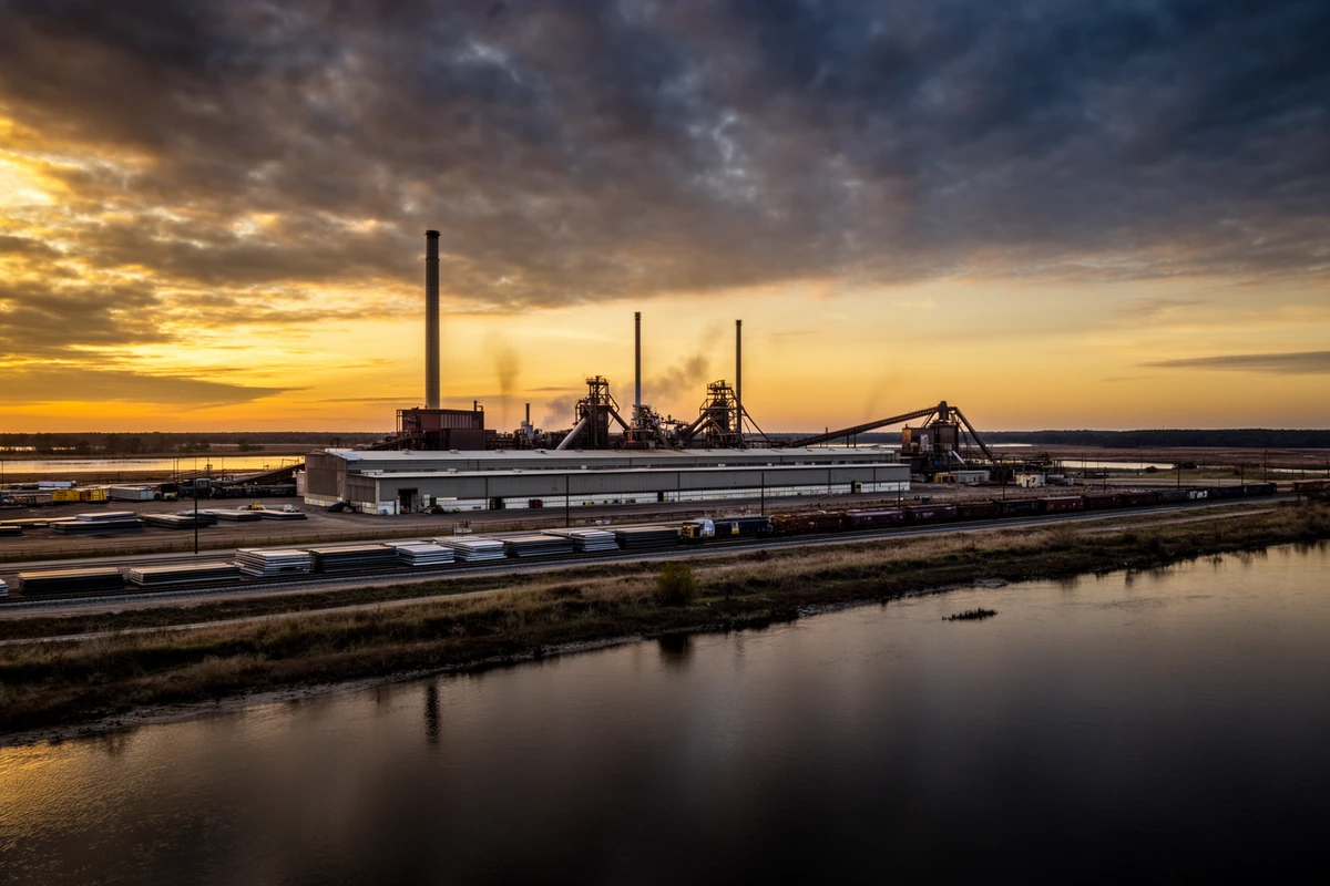
The fish houses that once anchored this county's economy are gone. What replaced them sits on the same river, a few miles upstream.
Present The County Today
Hertford County's 2020 census population was 21,552, spread across a county seat that is still one of the state's smallest, a college town with a genuine 19th-century core, a railroad town that grew into the commercial hub, and a handful of small communities whose 19th-century footprint has barely changed. The rivers that built the county are the same rivers that put flood maps at the center of due diligence on waterfront parcels today. Murfreesboro's river-port prosperity is why it has a real historic district and a stock of early-1800s homes rare in counties that grew later. The farm economy's long slide explains the older housing stock and manufactured homes scattered across former field edges — and the title questions that sometimes come with them. And the Nucor mill explains where a meaningful share of the county's paychecks come from today, the same way the herring runs once did. Read the county's past, and you have read a working outline of the market a buyer walks into now.
Primary Sources & Further Reading
The State Library of North Carolina's encyclopedia project. Source for the county's founding date, naming, county-seat evolution, and several biographical entries used here.
NC Dept. of Natural & Cultural Resources
The burning of Winton, and the NC Highway Historical Marker Program's marker A-95 documenting the Meherrin Tribe's history and recognition.
National Register of Historic Places
Listing documentation (via the National Park Service's NRHP database) for the Murfreesboro Historic District, the William Rea Store, and the Harrellsville Historic District.
N.C. Division of Marine Fisheries
River herring fishery management documentation, source for the 2005 stock assessment and 2007 statewide harvest moratorium.
Sources consulted for this page include NCpedia (the State Library of North Carolina's peer-reviewed encyclopedia project), NC DNCR's historical-marker documentation, National Register of Historic Places listing records, N.C. Division of Marine Fisheries river herring management documents, Thomas C. Parramore's 1962 North Carolina Historical Review article on the burning of Winton, Chowan University's own institutional history, published company history from Nucor and regional business-press coverage of the Hertford County mill, and Wikipedia-maintained summaries used only to cross-check dates and for the sameAs links in this page's structured data, never as the sole source for a factual claim. Numbered citations for specific claims appear below. Where sources genuinely disagree — Richard Jordan Gatling's exact birthplace within Hertford County chief among them — this page says so rather than picking one silently. Nothing here is estimated or invented.
- Hertford County's 1759 formation from Bertie, Chowan, and Northampton counties, and its naming for Francis Seymour Conway, Earl and later Marquess of Hertford, per NCpedia's geography entry, cross-checked against Hertford County's own government history page. NCpedia, "Hertford County," ncpedia.org/geography/hertford. ↩
- Ralph Lane's 1585–86 account of the Chowanoke principal town near present-day Harrellsville, and its confirmation by 1980s archaeological excavation, per NCpedia's Chowanoac Indians entry. NCpedia, "Chowanoac Indians," ncpedia.org/chowanoac-indians. ↩
- The Chowanoke population decline, the 1733 merger into the Tuscarora Nation, and the 1820 record of extinction as an independent people, per Joseph Norman Heard, Handbook of the American Frontier: The Southeastern Woodlands (Metuchen, N.J.: Scarecrow Press, 1987), as reflected in the Wikipedia-maintained summary of Chowanoke history, cross-checked against NCpedia's Chowanoac Indians entry (as above). ↩
- The Meherrin's 1691 move into present-day North Carolina, the 1705 Maharineck reservation, 1729 tributary status, the 1975 modern tribal government, and 1986 North Carolina state recognition, per the NC Highway Historical Marker Program's marker A-95, "Meherrin Tribe." NC DNCR, "Meherrin Tribe (A-95)," dncr.nc.gov/blog/2023/12/04/meherrin-tribe-95. ↩
- The February 19, 1862 Union approach to Winton aboard the USS Delaware and the Confederate volley from the bluff, per NCpedia's account of the burning of Winton, cross-checked against NC DNCR's blog. NCpedia, "Winton, Burning of," ncpedia.org/winton-burning. ↩
- The February 20, 1862 burning of Winton — the courthouse, military stores, and the great majority of the town's roughly 300 residents' homes and businesses — its status as the first NC town burned by Union troops and the only one burned in its entirety, and the "total war" historiographical framing, per Thomas C. Parramore, "The Burning of Winton in 1862," North Carolina Historical Review 39, no. 1 (Winter 1962), as cited and cross-checked against NCpedia's "Winton, Burning of" entry (as above) and NC DNCR, "Burning of Winton by Union Troops, 1862," dncr.nc.gov/blog/2016/02/20/burning-winton-union-troops-1862. ↩
- Murfreesboro Historic District, National Register of Historic Places reference #71000593, listed August 26, 1971, nine contributing buildings including the William Rea Store (c. 1790, separately NRHP-listed September 15, 1970), the John Wheeler House (c. 1800), Melrose (c. 1810), and the Walter Reed House (c. 1845), per National Register documentation as reflected in the Wikipedia-maintained summaries of the district and the Rea Store. ↩
- Ahoskie's 1885 origin as a railroad log-train siding, 1889 post office, 1890 first passenger train, and January 24, 1893 incorporation, per Hertford County's own government history page and the Wikipedia-maintained summary of Ahoskie's history, cross-checked against each other. ↩
- Chowan Female Institute's May 1848 proposal, October 11, 1848 opening with eleven students under Dr. Archibald McDowell, and its 1910/2006 renamings to Chowan College and Chowan University, per NCpedia's entry and the NC Highway Historical Marker Program's marker A-19. NCpedia, "Chowan College," ncpedia.org/chowan-college. ↩
- Calvin Scott Brown's 1885 founding of Chowan Academy in Winton, its March 7, 1887 incorporation as a "colored school" by the NC General Assembly, its renamings to Waters Normal Institute and C.S. Brown High School, and Brown's death in 1936, per NCpedia's biographical entry. NCpedia, "Brown, Calvin Scott," ncpedia.org/biography/brown-calvin-scott. ↩
- Harrellsville's 1820s founding by the Harrell family, its 1827 post office, its renaming from Bethel in the 1860s, and the 1995 National Register listing of the Harrellsville Historic District, per the Wikipedia-maintained summary of Harrellsville's history, drawn from National Register listing records. ↩
- Richard Jordan Gatling's September 12, 1818 birth date and his career as an inventor, per NCpedia's biographical entry, which locates his birthplace in the "Maney's Neck section of Hertford County" rather than naming Como specifically; Como's own local tradition and the Wikipedia-maintained summary of Como's history credit the town directly. Both citations are real; this page states the discrepancy rather than resolving it silently. NCpedia, "Gatling, Richard Jordan," ncpedia.org/biography/gatling-richard-jordan. ↩
- The 2005 NC Division of Marine Fisheries stock assessment and the 2007 statewide river herring harvest moratorium, per NCDEQ's river herring fisheries management documentation. ↩
- Nucor Steel Hertford County's September 2000 opening on roughly 990 acres at Cofield, its approximately $300 million construction cost, its 2011/2012/2013 line expansions, and its current employment and compensation figures, per Nucor's own published company history and regional business-press coverage (Business North Carolina, the NC Chamber). ↩